The Togariro Crossing
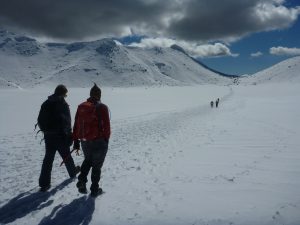
The Tongariro Crossing is 19km hike passing through volcanic terrain including 2 volcanoes which are still active). As it is spring, a substantial part of the route is still covered in snow and ice, so we went with a small guided group and learnt how to use ice axes in an emergency, as well as being given some essential crampons and gaiters.
All geared up, and after ice axe training (which involved sliding down a steep face, using the axe to stop), we felt like real mountaineers! Sophie was also pleased to be class pet, with a perfect ice axe rescue technique. And we both aced sliding down a slope on our bums!
The views from the top were incredible. They were made more special by knowing that we were a privileged few – we had climbed many steps and steep, icy slopes to see them. On top of that, they skies were the clearest they had been in months, even the guides got their cameras out! Tongariro makes it to our list of best days so far on tour.
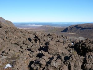
Volcanic ascent (past “mount doom”)
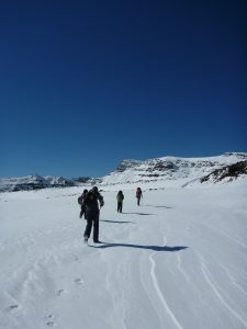
Soft snow section
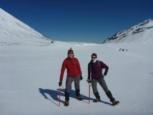
Mountaineer poses
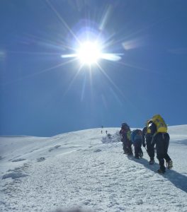
Climb up steep ice slope
View from top (most of the ground at the top oozed steam!)
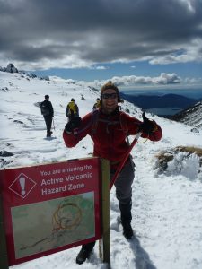
Olly entering the danger zone (looking surprisingly happy about it)
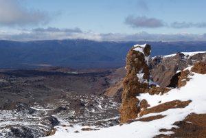
Plateau near the peak; it was surrounded by craters and lakes
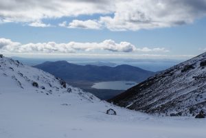
Descent view overlooking Lake Taupo